
Their path will follow, in part, the Lyke Wake Walk (another internet search for you), and the Cleveland Way. Both of these are long distance pathways, well trodden over the centuries when Shanks's pony was the only means of transport.
Although this route is reasonably short at 12 miles, it could prove to be one of the hardest sections. The walkers will have to climb up and down five high points along their route before they get to their destination, Clay Bank Top. This itself is a high point, being the highest part of the B1257 road between Stokesley and Helmesley. Clay bank is the name of the road as it rises to this point.
There seemed to be little of interest along this route, as the photos they produced for me to work with are mainly of the stupendous views open to them for almost the full length of their walk.
First, here they are setting off from the Bluebell Inn. :-

The next one is taken looking back towards Ingleby Cross and the Vale of Mowbray as the path starts to rise. :-

Reaching a forest track, our Trio made their first, and hopefully only, navigation error. They took a wrong turning in an area of tree felling and ended up at a dead end. They were much lower than they wanted to be :-
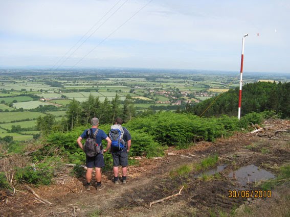
and had to strike up the hill through the heather and bracken to reach their correct route :-


Most of the forested areas hereabouts are man made pine forests. In Scugdale there was a welcome change to deciduous woodland. Here's Patrick propping up a tree. :-

This is one of the man made pine forests further along the route. :-

The Cleveland Hills, part of the North York Moors National Park, seem to come to an abrupt halt on their northern side, falling away steeply to the coastal plain. The views are breathtaking. This one from Carlton Moor looks all the way to Middlesbrough and Teesside, with a faint view to the North Sea beyond. :-

Southward the hills are covered with bracken and heather. Windswept for most of the time. :-


The only features seem to be boundary stones and Ordnance columns (known more commonly as trig points). These are the ones on Carlton Moor. :-

The path goes over Cringle Moor, to Cold Moor, then on to Hasty Bank . This is Cold Moor taken from the Wain Stones where I was sitting waiting for them. :-

The Wain Stones are a jumble of large boulders, seemingly thrown there by a giant hand. They are the last high point on the walk. From here the path is level and well paved all the way to Clay Bank Top. Here is a selection of views of them:-


This is the pathway through the Wain Stones showing the high point of Cold Moor on top of which our Trio will eventually appear. :-

Lo and Behold! Here they are! :-

That's a telephoto shot. This is really how far away they are. :-

At last the Wain Stones are reached. :-

Moving on, the way to Clay Bank Top over Hasty Bank is well paved. :-

With great views to the north west. :-


Clay Bank Top is amongst the trees in the middle ground in the second photo above. On the hillside beyond you can just about discern the pathway at the start of tomorrow's journey.
This is Clay Bank Top, the B1257 road. I'd parked my car there because the nearest accommodation we could get for the night is at Chop Gate, two miles south. I'll drive them back here in the morning ready for the next leg, Clay Bank Top to Glaisdale. :-

IT'S A 19 MILER! SECOND LONGEST SECTION OVER HEATHER CLAD, WINDSWEPT MOORLAND. I JUST HOPE THE WEATHER STAYS DRY!
P.S. There was an amusing incident during this walk. At one point a three legged dog ran past them, or should I say hopped past them.

Chris commented, "Well! He won't need to cock his leg leg up for a pee!".
To which, after thinking for a bit, Joe replied, "What if it forgets and cocks the other one up!"
No comments:
Post a Comment